
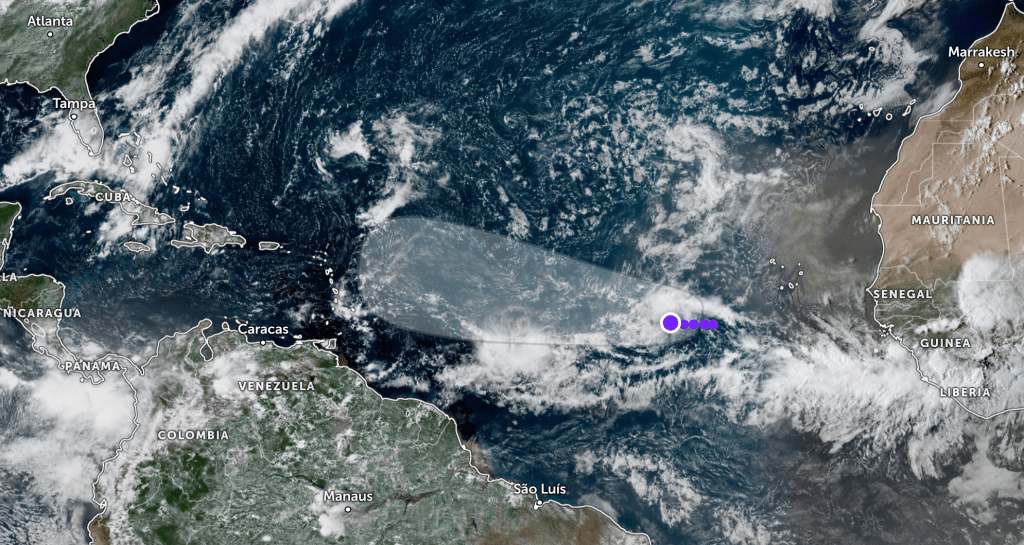
A tropical wave in the eastern Atlantic, identified as Invest 91L, is expected to organize later this week or over the weekend, according to the National Hurricane Center.
The disturbance currently has a 50% chance of development within 48 hours and an 80% chance over the next seven days. It is producing showers and thunderstorms several hundred miles west-southwest of the Cabo Verde Islands while drifting west-northwest at 5–10 mph.
Forecasters say its future path will depend on how quickly it intensifies. A weaker system would likely track farther west, while a stronger tropical storm or hurricane would be pulled north sooner.
As Invest 91L moves closer to the Leeward Islands, it will encounter warmer waters and a more favorable environment for strengthening. While its long-term track remains uncertain, meteorologists say it bears watching closely in the days ahead.
The next storm name on the 2025 Atlantic list is Gabrielle.
Follow the St. Pete-Clearwater Sun on Facebook, Instagram, Threads, Google, & X
(Image credit: Zoom Earth)
PIE-Sun.com: local St. Pete-Clearwater news


Leave a comment