
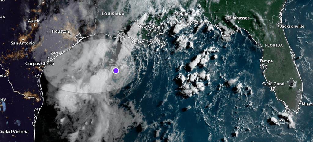
A disturbance in the north-central Gulf of Mexico is producing scattered showers and thunderstorms as it drifts west-northwest, according to the National Hurricane Center.
Forecasters say the area of low pressure could move inland over southeastern Texas or western Louisiana by this weekend, which would end any potential for tropical development.
While the system may slowly organize over the next few days, the NHC gives it just a 10 percent chance of forming over the next 48 hours—and the same low chance over the next week.
Regardless of development, heavy rainfall is possible along parts of the northern Gulf Coast through the weekend.
Follow the St. Pete-Clearwater Sun on Facebook, Instagram, Threads, Google, & X
(Image credit: Zoom Earth)
PIE-Sun.com: local St. Pete-Clearwater news


Leave a comment