
Hurricane Milton has just been upgraded to a major hurricane with top winds reaching 120 mph. (image credit NOAA)
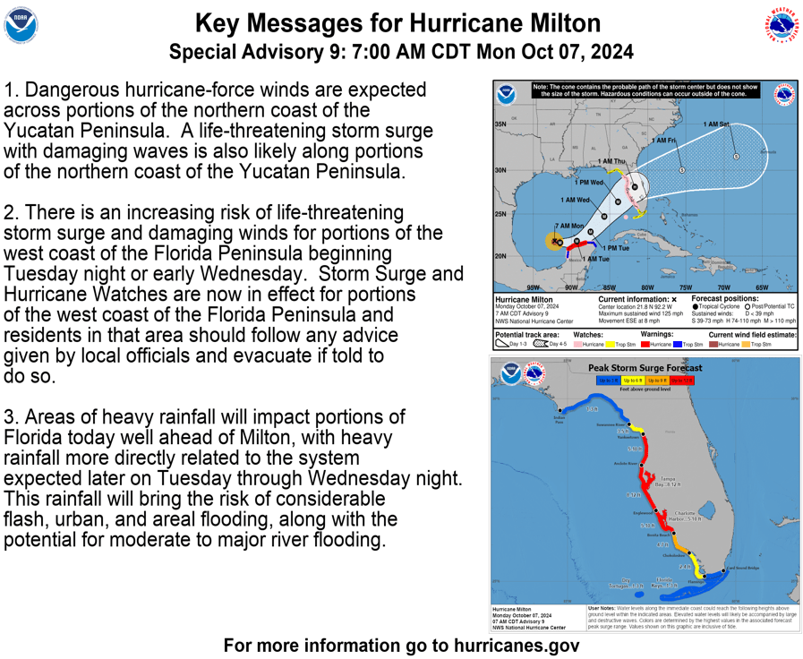
Hurricane and storm surge watches are now in effect for our west coast. The National Hurricane Center (NHC) forecasts an 8 to 12-foot storm surge from the Anclote River to Englewood, but this could change as we get a clearer picture of the landfall point. Remember that the surge will be higher south of the landfall point and lower north of it.
There’s high confidence that Milton will cross our peninsula, but there’s still uncertainty about the exact timing and landfall location. Milton is expected to intensify further today, though some weakening is likely before it makes landfall. Strong, damaging winds will move inland as the storm heads towards the east coast.
The challenge we’re facing is the limited time for decision-making. Without a confirmed landfall point, it’s best to prepare for the worst-case scenario. This situation is different from Hurricane Helene, where we had more certainty about storm surge heights because the storm paralleled our coast.
Stay safe and keep an eye on local updates!


Leave a comment