
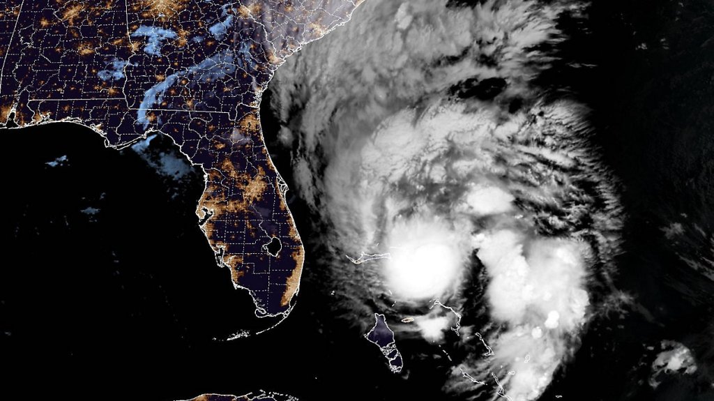
Tropical Storm Imelda has formed over the Bahamas with maximum sustained winds of 45 mph, becoming the ninth named storm of the 2025 Atlantic hurricane season. The storm is currently moving north at 8 mph and is forecast to strengthen into a hurricane by Tuesday.
Imelda has become more organized over the past 24 hours, with outer rain bands already affecting Florida’s east coast. The storm’s path remains uncertain, but forecast models suggest it will move north along Florida’s Atlantic coast before turning sharply eastward into the open Atlantic early Tuesday.
The National Hurricane Center predicts a slower-moving storm that will curve more sharply to the east, keeping the center farther from the U.S. coast. However, the presence of Hurricane Humberto to the east may weaken steering currents and affect the storm’s trajectory.
Tropical Storm Warnings are in effect for the Bahamas. Heavy rainfall and potential flash flooding are expected to threaten portions of Florida’s east coast and the Carolinas through midweek, regardless of the storm’s exact path.
Forecasters emphasize that impacts may extend beyond the cone of uncertainty, and residents near the forecast path should monitor updates and prepare accordingly.
Follow the St. Pete-Clearwater Sun on Facebook, Instagram, Threads, Google, & X
(Image credit: NOAA)
PIE-Sun.com: local St. Pete-Clearwater news


Leave a comment