
University of South Florida researchers have upgraded their CRIS-HAZARD flood monitoring app following its real-world testing during hurricanes Helene and Milton in 2024.
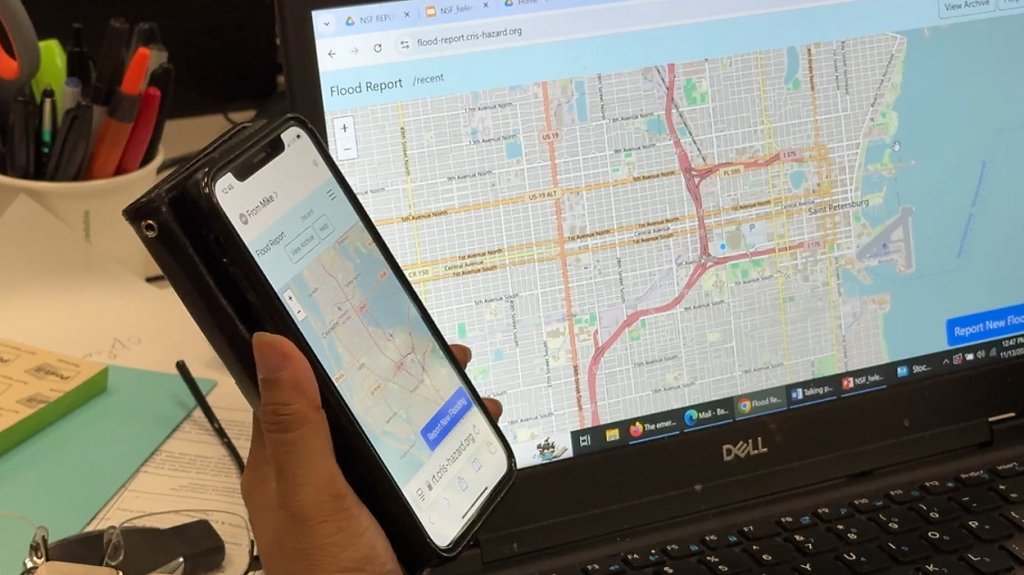
The crowdsourcing app, launched in September 2024 by USF geosciences professor Barnali Dixon, allows residents to upload photos of neighborhood flooding to track water levels. Dixon compared the platform to the Waze app, with neighbors contributing data to help monitor rising water levels.
The system combines user-submitted photos with data from solar-powered cameras installed across Pinellas County cities, including St. Petersburg, Safety Harbor, and Dunedin. The network expanded from eight cameras initially to 31 this year.
Key upgrades include artificial intelligence that can distinguish between minor and major flooding in uploaded photos. The system utilizes AI and computer vision to translate residents’ lived experiences into usable data for understanding the nature, extent, and depth of flooding.
During the hurricanes, researchers collected data on the amount of water that rose and when. “Helene is the one we were able to characterize more, because we had more cameras in the area that experienced storm surge,” Dixon said.
The technology could help emergency responders determine appropriate rescue vehicles based on water depth. Gulfport is next on the list for camera installation, with researchers collaborating with floodplain managers to identify communities that most need tracking.
The project’s National Science Foundation grant will end in 2026, necessitating new funding for expansion to other counties. The flood map is accessible at www.stormsquard.org.
Follow the St. Pete-Clearwater Sun on Facebook, Instagram, Threads, Google, & X
(Image credit: Spectrum News)
PIE-Sun.com: local St. Pete-Clearwater news


Leave a comment