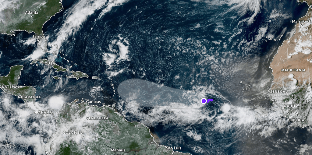
The National Hurricane Center is monitoring Invest 91L in the central tropical Atlantic, which is projected to become Tropical Storm Gabrielle in the coming days.
Forecasters give the disturbance a 60% chance of development within 48 hours and a 90% chance over the next week.
Because the system is moving slowly, meteorologists say there will be plenty of time to track its progress. By this time next week, it should still be east of the Lesser Antilles, leaving 10 to 12 days of monitoring ahead.
Forecast models remain inconsistent, in part because the system lacks a well-defined low-level circulation. As of Friday morning, short-term model projections were spread by as much as 250 miles.
Longer-range guidance has shifted the potential path farther south, which could bring impacts to the islands in 7–8 days. However, experts caution there is still significant uncertainty.
How quickly the system organizes will also shape its track. A stronger, better-defined storm would likely curve north sooner, while a weaker one would continue drifting west.
For now, forecasters emphasize that many details remain unknown.
Follow the St. Pete-Clearwater Sun on Facebook, Instagram, Threads, Google, & X
(Image credit: Zoom Earth)
PIE-Sun.com: local St. Pete-Clearwater news


Leave a comment