
Tropical Storm Erin has developed in the eastern Atlantic, marking the fifth named storm of the 2025 Atlantic hurricane season.
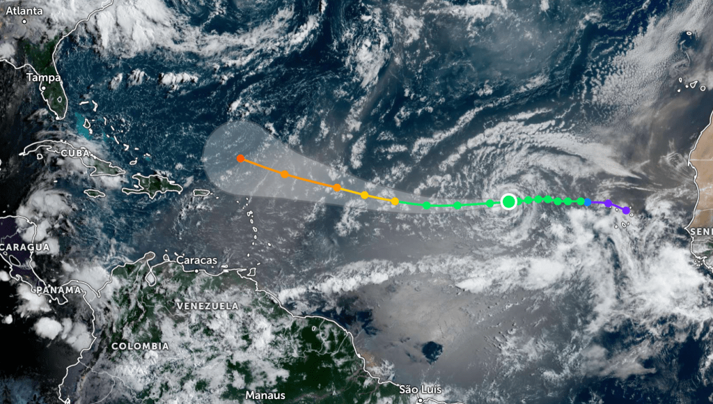
With maximum sustained winds near 45 mph, Erin is moving west at 22 mph and is expected to intensify as it tracks west-northwest through favorable conditions. Forecasters anticipate it could become the season’s first hurricane later this week and potentially strengthen into a major hurricane by the weekend as it passes north of the Caribbean.
Meteorologists caution that the “cone of uncertainty” shows only the possible location of the storm’s center, not the full range of potential impacts. Areas outside the cone may still experience effects, so residents in nearby regions should stay alert and prepare.
Forecast models suggest Erin will maintain its west-northwest motion before turning north sometime this weekend or early next week. It remains too soon to know if the storm will affect the U.S. coastline.
Spaghetti plots—maps showing multiple forecast model tracks—can help indicate whether models agree on Erin’s path, but they do not provide details on the storm’s strength, wind speeds, flooding, or surge risks.
Follow the St. Pete-Clearwater Sun on Facebook, Instagram, Threads, Google, & X
(Image credit: Zoom Earth)
PIE-Sun.com: local St. Pete-Clearwater news


Leave a comment